Better Off Dead
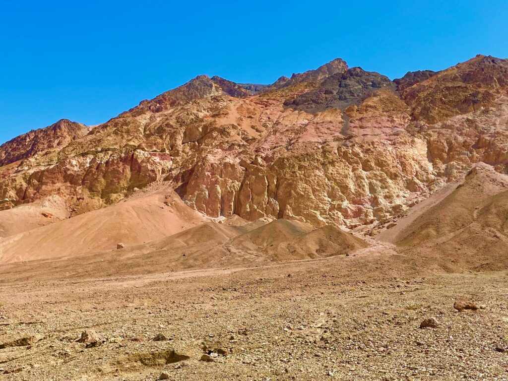
Into the depths of the valley we head with little to no idea exactly what to expect. We’re still at 3,000 feet, so how long and how steep is this nosedive below sea level going to be? Past Deadman Pass, past Funeral Peak, down we go, doggedly following CA 190 to our destination at Furnace Creek. If you haven’t guessed by now, we are headed somewhere hot, really hot. Death Valley, complete with its stories, ghost towns, borax and gold mines, sand dunes and colorful names depicting slow death in a merciless, unrelenting heat. The hottest temperature ever recorded was 134 degrees right here at Furnace Creek back in 1913. The ground temperature can top 200 degrees; it’s literally an oven.
Fortunately for us, today is only 91, and tomorrow will be slightly cooler. But the wind is blowing about 25 mph, so sand and lots of particulate fill the air. We’ve made it to Furnace Creek and another mile past the Inn at the Oasis to The Ranch. We pull our caps low, duck against the blast and make our way into the General Store. We check in, dump our stuff in our room, and head to dinner at the Last Kind Words Saloon. We’re rooming at The Ranch in the Oasis at Death Valley. It’s not cheap and reservations here are no different than any other national park these days – required if you expect to find a room. Making reservations here is a bit misleading. The Ranch, while comfortable, is the former livelihood for a hardy, turn of the century band of cowboys. The Inn is its upper crust cousin, a more interesting stay just up the hill. Where the Ranch is rustic and basic, the Inn is where the movie star history resides. Hollywood elites like Marlon Brando, Clark Gable, and Carole Lombard stayed at the Inn, and its recent renovation restores that 1930s ambiance. But don’t be surprised at the nightly rates.
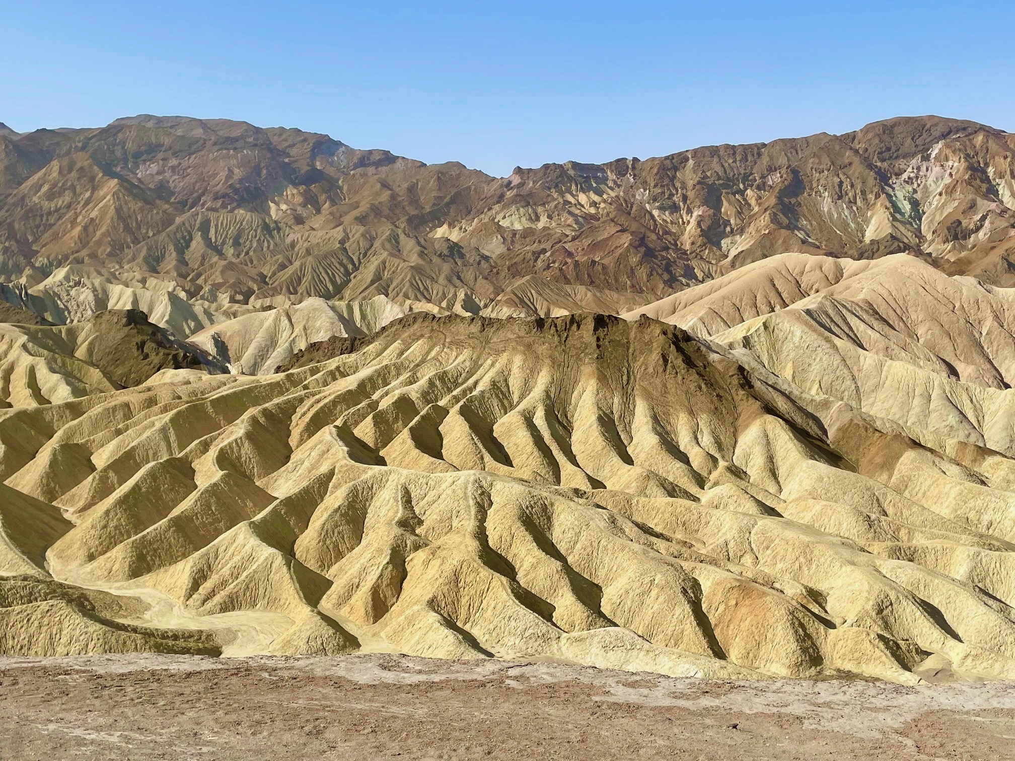
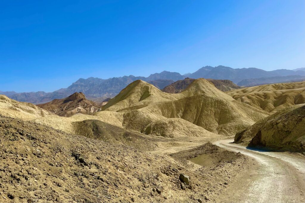
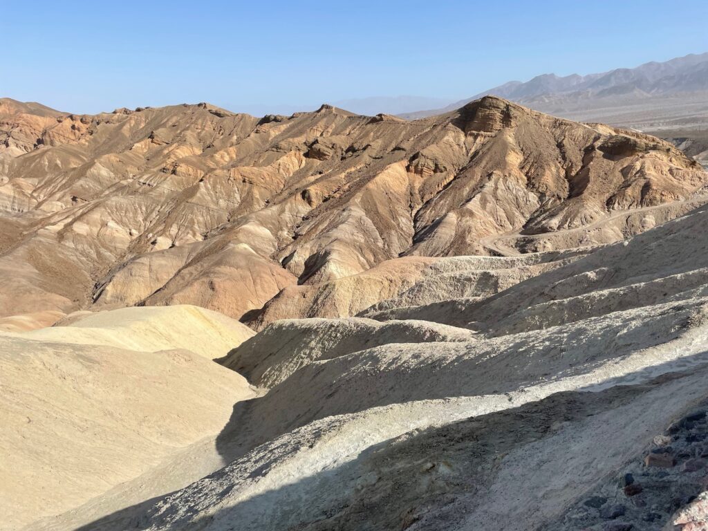
Up the entrance road is Zabriske Point, and easy and popular viewpoint to survey the kinds of gullys and rock formations you will see throughout the park. Walking paths make for a relatively easy way to get out an experience the scale of it all with minimal effort.
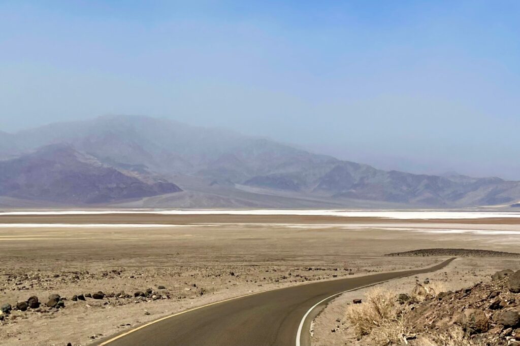
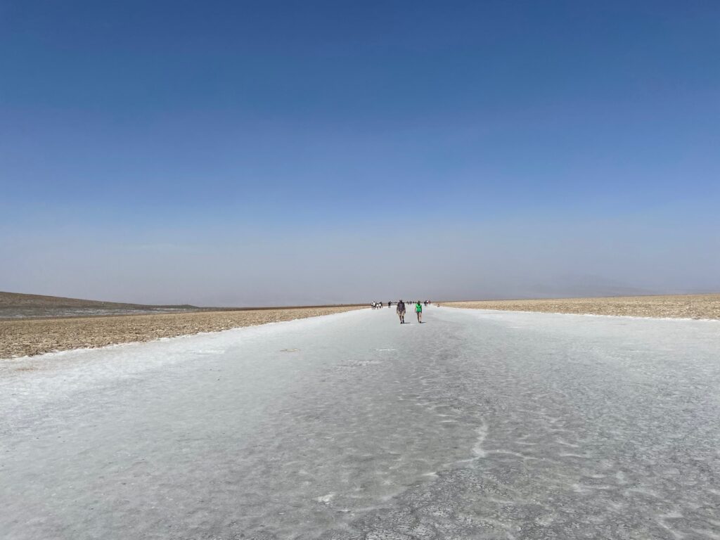
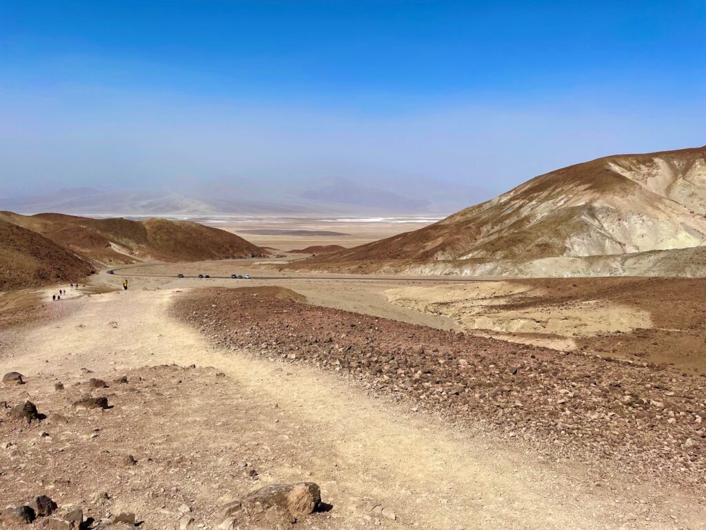
From The Ranch we head south 17 miles past the Devil’s Golf Course to Badwater Basin, the lowest part of the US at -282 below sea level. The names in this place are always so literal. There’s no doubting the ominous warnings or meanings of the potential dangers held by every locale. Badwater Basin is a flat plane of salt and mineral crystals all stacked roughly about. The only passable area is the freeway-like path already pounded flat by the millions of footprints traversing this spot each year. It’s an interesting spot, especially when you take your first steps onto the flats and realize your path is largely compacted salt crystals that have formed an almost smooth, spongy walking surface. Fascinating.
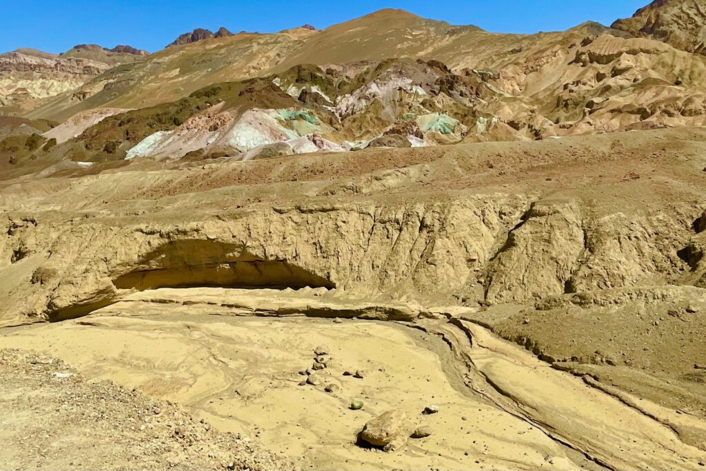
On a good day, you can see across the valley to 11,049 foot Telescope Peak looming mightily from below sea level, but the wind has blown so much junk into the air we can barely see across the basin. Ah well, so much for the vagaries of weather. From Badwater Basin we backtrack to Artist’s Drive, a one-way loop road (this one’s paved) past the highlight of the loop, Artist’s Palette. Lots of fun things to see along this drive, including the sudden and gravity defying dips in the road. The dips can drop 40-50 feet into narrow, deep gullys in a matter of a few yards, and then rise just as suddenly and dramatically on the other side. When the road sign says “DIP” here, they’re not kidding.
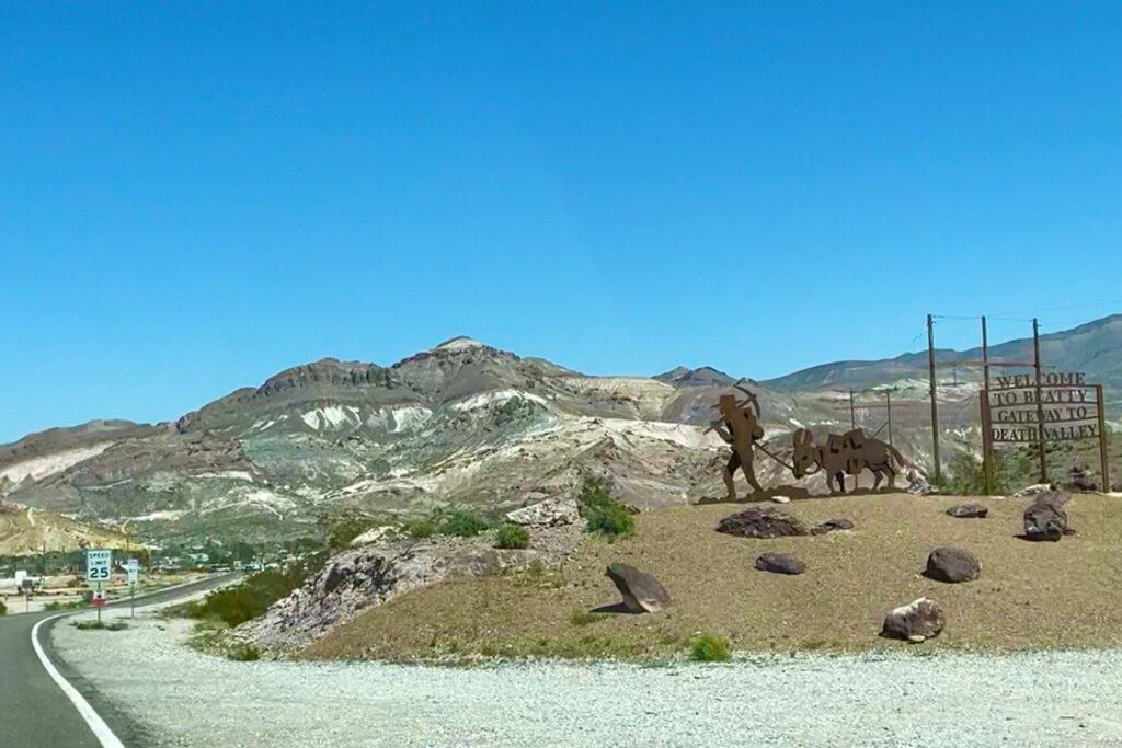
From Artist’s Drive we loop back through Furnace Creek on our way, we think, out the north portal of the park through Scotty’s Castle. The Castle has been closed since flash flooding damaged it in 2015. But even though the Castle is closed, we still figure we can take this longer route out of the park via its namesake road, see a few more sites like the Mesquite Flat sand dunes. But after reaching Grapevine for the turnoff to Scotty’s Castle, we are rudely surprised that the road is also closed. What the hell?! They didn’t say anything about the road being closed! Guess we’ll be backtracking the 30 miles or so to the Beatty road turnoff and exit the park that way east to Beatty, NV.
Just outside the park is the ghost town of Rhyolite. Rhyolite was a boom and bust gold town. Started in 1905 it grew to about 5,000 people until the Montgomery Shoshone Mine became unprofitable a few years later. In the meantime, Rhyolite became a full blown town, with a complete city infrastructure that included modern water and electrical grids, telephones, hospital, opera house and stock exchange. But it vanished almost as quickly. Shortly after 1920, the last residents left town and Rhyolite became nothing more than a tourist attraction and location for filming movies.
There are a lot of boom and bust stories in these parts, and they’re not all ranchers and gold miners. The famous 20-Mule Team Borax was developed by William Tell Coleman in this valley in 1883 after the mineral was discovered here. Surprisingly his company, the Harmony Borax Works, only ran for five years until his financial empire collapsed and he was subsequently bought out by Francis Smith, “The Borax King” and his Pacific Coast Borax Company. Those 20-mule teams hauled the borax 165 miles across the desert to the railroad hub at Mojave (hum – still desert). Smith used that 20 Mule Team as a symbol and trademark that existed into the 1960s. I still remember the TV ads. Nevertheless, by the turn of the century most of the mining operations here closed down. The Borax Museum at The Ranch highlights this history.
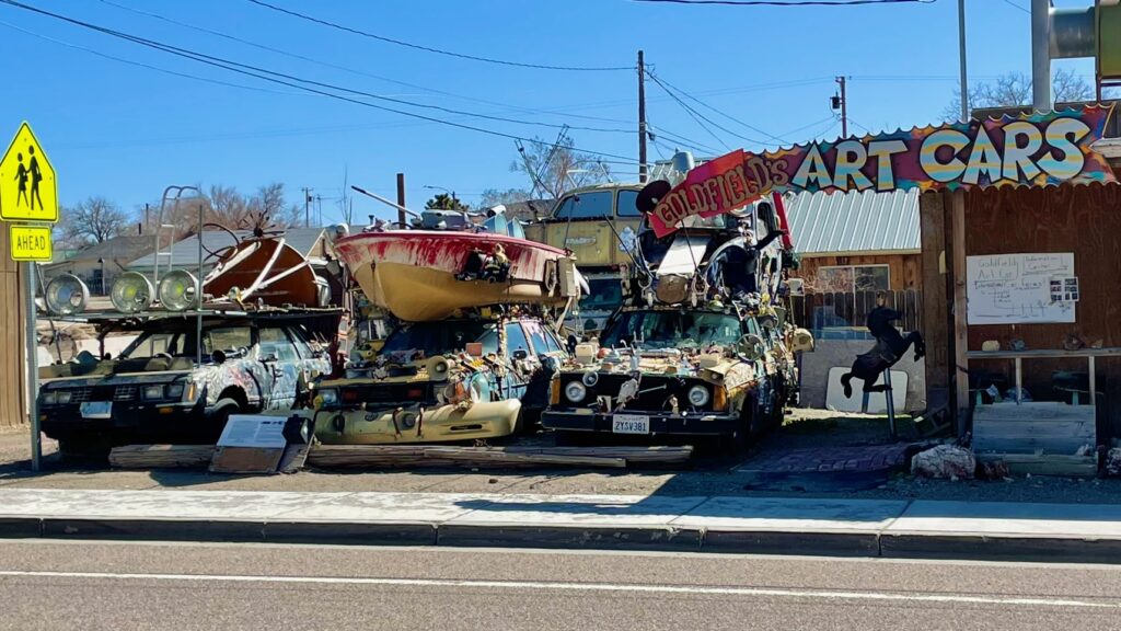
From Beatty, we turn north onto US 95, haul the 52 miles to Scottys Junction (which is nothing to write home about, so we won’t do that here), then on to Goldfield (the imagination just piques at the local naming conventions) where the pass crests at 6,087 feet. There’s nothing particularly different about Goldfield, except for one thing. You do notice the preservation of some 19th century brick buildings amidst the more modern attempts, but that’s not it. The difference is the ramshackle ‘Goldfield’s Art Cars.’ It’s exclamation of its trade holds a probably cringingly prominent place to some on Main St. Look at the picture. I don’t think I need to say anything more.
From this desert highlight, we keep north on US 95 until we hit another surprise – Hawthorne, NV and the world’s largest military munitions depot. With somewhere between 2,400 and 3,000 munitions bunkers, it covers 226 square miles. You can see hundreds of the bunkers from the road. The town of Hawthorne is essentially surrounded by the depot, to the point you almost feel like you’re driving through it. Fascinating glimpse at military might. From there we meander our way to Susanville and SR 139 to Klamath Falls to spend the afternoon and evening at the Running Y resort. Then, it’s the final leg up SR 140 to US 97 to cut across the Cascade Mountains on SR 58 and hit I-5 at Eugene. After that, it’s just a ho-hum ride home and the desire to leave town again soon on another adventure.